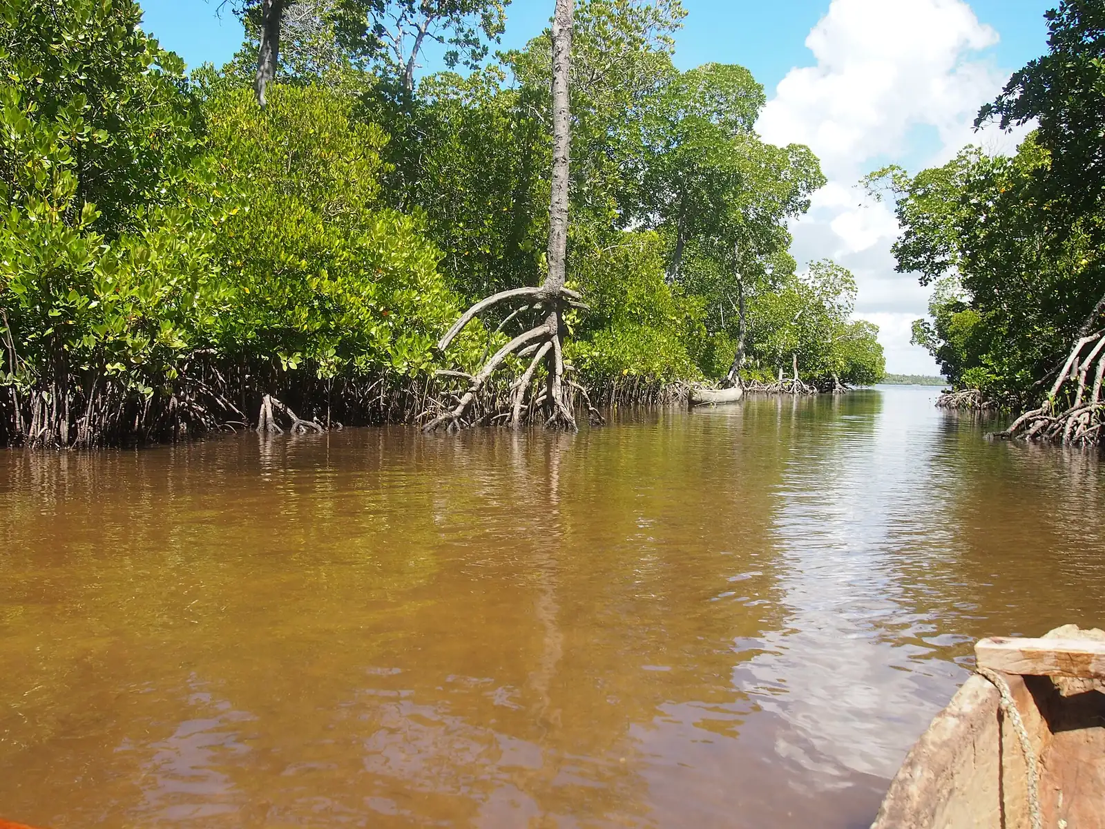
Kenya's Indian Ocean coastline holds some of the country's most carbon-dense ecosystems. Mangrove forests along the coast store carbon in their trunks, branches and roots, and in the waterlogged soil beneath them. Because that soil can hold carbon for long periods when it stays flooded, mangroves are usually grouped under the term "blue carbon": carbon captured and stored by coastal and marine ecosystems.
Why Mangroves Store So Much Carbon
Mangroves grow in tidal, salty water where oxygen is scarce. Leaves, wood and roots decompose slowly under these conditions, so carbon builds up in the soil over time instead of returning to the atmosphere. Per hectare, mangrove ecosystems are among the most carbon-dense on Earth. They also protect shorelines from storm surges and provide nursery habitat for fish that coastal communities depend on.
How Mangrove Projects Earn Credits
Blue carbon projects generate credits in two main ways. Restoration projects replant or regenerate degraded mangrove areas, and the credits reflect the carbon that new growth captures over time. Conservation projects protect standing mangroves that would otherwise be cleared, for example for charcoal, aquaculture ponds or coastal development, and the credits reflect the emissions avoided. Many developers combine both approaches within one project area.
The most widely used methodology for this work is Verra's VM0033, Methodology for Tidal Wetland and Seagrass Restoration. It sets out how a project measures carbon stocks in biomass and soil, how it estimates baseline emissions, and how it monitors change over the project's life. Projects must also demonstrate additionality, meaning the restoration would not have happened without carbon finance, and must account for leakage, so that clearing does not simply move to another area.
Where Kenya's Mangrove Projects Are
Kenya's mangrove cover is commonly put at about 61,271 hectares along the 536-kilometre coastline, though estimates vary by source and survey date. Lamu County holds roughly 60% of that area, and Kwale County, which includes Gazi Bay and the Vanga-Funzi system, is the other major block, with about 8,354 hectares. The cover is also shrinking. A State Department for Forestry estimate puts annual loss at about 0.7% of national mangrove cover, so restoration and protection have to keep pace with that loss for any project to hold its baseline.
Kenya's mangrove cover is concentrated in several creek systems, including those around Lamu, Kilifi and Malindi, Gazi Bay in Kwale County, and the Vanga area near the Tanzanian border. These sites differ in how much mangrove remains, how degraded they are, and how close they sit to fishing and farming communities. Those differences shape credit potential. A site with large areas of degraded mangrove offers restoration opportunity, while an intact creek offers a protection case that depends on credible evidence of threat.
Community Benefits and Local Rights
Coastal communities use mangroves directly for fuelwood, building poles, fish breeding grounds, and harvesting crabs and shellfish. Any carbon project that changes how these resources are used needs a clear agreement with the people who depend on them. Buyers should look for documented consultation, a benefit-sharing arrangement, and an assessment of how any restrictions affect livelihoods. The details depend on the project's legal structure and on the agreements signed with local community groups and county authorities.
What Buyers Should Check
Blue carbon credits carry specific risks that buyers should weigh alongside price. Check whether the carbon stock baseline was measured in the field, not only modelled from satellite imagery. Ask how the project handles reversal risk from storms, die-off or illegal cutting, and whether a buffer pool or other risk mechanism covers it. Confirm the project's status and issuance history on the Verra registry, review the verification reports, and ask who holds the land and resource rights for the area.
Frequently Asked Questions
Are mangrove carbon credits the same as forest credits? Not quite. A larger share of the carbon sits in the soil, and measurement and monitoring methods differ accordingly. Each credit still has to meet the same basic tests of additionality, permanence and leakage.
Do mangrove projects earn credits for ocean carbon? No. Methodologies such as VM0033 cover tidal wetlands and seagrass, and credits relate to the carbon stored in the mangroves and soils within the project boundary, not to seawater.
How long before a mangrove project issues credits? Timelines depend on site preparation, baseline work and verification. Restoration projects usually need several years of growth before issuance is significant, so buyers should check verified issuance history rather than projected volumes.
Are mangrove projects riskier than forest projects? They can be. Storm damage, die-off and illegal cutting all threaten stored carbon after credits are issued. Look for the buffer or reversal arrangement the methodology requires, and read the project's monitoring reports to see how it has responded to past losses.